Bilwaradahalli, Bannerghatta Road
A semi-rural pocket on the southern reach of Bannerghatta Road, pincode 560083, postal head office Gottigere, Bangalore South assembly and Bangalore Rural parliamentary constituency, elevation roughly 900 m. This is what the locality is actually like, and where Nambiar Beverly Park stands in it.
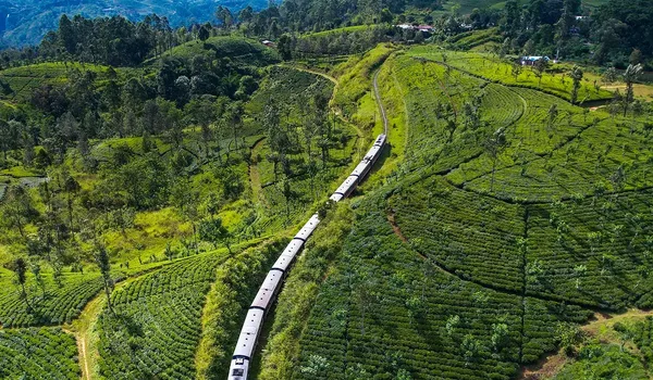
Bilwaradahalli is one of the villages strung along the southern reach of Bannerghatta Road, between Gottigere and Bannerghatta, in south Bangalore. Its pincode is 560083 and its postal head office is Gottigere; it falls in the Bangalore South assembly constituency and the Bangalore Rural parliamentary constituency, and the ground here stands at roughly 900 m above sea level, like Bengaluru generally, high, dry Deccan plateau country. It is not a suburb and does not read like one. This is granite-and-farmland land on the edge of the Bannerghatta green belt that has been turning residential from the Gottigere end southward, one gated scheme at a time, since the city pushed past the NICE Road. Nambiar Beverly Park is here, geo-tagged at 12.823744° N, 77.571837° E, 3 km from the Bannerghatta Nature Camp.
Bilwaradahalli at a Glance
- Locality: Bilwaradahalli, on Bannerghatta Road, south Bangalore.
- Pincode: 560083; postal head office Gottigere.
- Constituencies: Bangalore South assembly; Bangalore Rural parliamentary.
- Elevation: no reliable village-level figure is published. Bengaluru as a whole stands at roughly 900 m on the southern Deccan plateau.
- Road: Bannerghatta Road, State Highway 87, is the main arterial serving the pocket.
- Coordinates of the project: 12.823744° N, 77.571837° E.
- Distances: 3 km to the Bannerghatta Nature Camp; ten school distances by car and by bike, the nearest, Ryan International School, at 3 km; eight hospital distances, the nearest Medax Hospitals, Gottigere at 5.9 km; six mall distances, the nearest Royal Meenakshi Mall at 7.5 km; six tech-park distances, the nearest Primeco Towers at 10.6 km; and three metro stations, 12.5 km to Yelachenahalli and to Silk Institute, both operational on the Green Line, and 6.3 km to Kalena Agrahara on the Pink Line, which is not open yet; and three BMTC bus stops, 190 m to Bilavaradahalli Cross, which is limited at about fourteen departures a day, 1.5 km to Bilavaradahalli and 2.3 km to Bannerughatta Circle. Travel times are published for the ten schools, eight hospitals and six tech parks, and are typical figures that vary with traffic and time of day; malls are distance-only. The airport is 68 km away, 2 h by car and 1 h 58 min by bike, and Electronic City is 15 km, 30 min by car and 30 min by bike.
What the Pocket Is Actually Like
Drive south past Gottigere and the change is obvious almost immediately. The continuous shopfronts stop. The apartment towers stop. What replaces them is highway frontage with gaps in it, fields, plantation, granite outcrops, a village settlement, then more open ground. Bilwaradahalli is one of those settlements. The built form is low: village houses, sheds, small farm holdings, a scatter of new compound walls where land has been consolidated for gated schemes. There is no high street in the way that Jayanagar or JP Nagar has one; there is a road with things arranged along it.
The consequences are practical and cut both ways. Air and noise here are markedly better than anywhere on the built stretch of the corridor, sightlines are long, and the land does not have the density of construction that makes summers in central Bangalore unpleasant. Against that, everything institutional, the multi-speciality hospitals, the malls, the metro terminus under construction, is north of you on the same road, and a car is not optional. Retail is genuinely local: provision stores, a chemist, small eateries, with the weekly-shop scale of retail concentrated at Gottigere and Kalena Agrahara.
The 560083 Neighbourhood
Bilwaradahalli shares its pincode with the settlements around it, Bannerghatta, Kalkere, Ragihalli, Sakalavara and their neighbours, a cluster of villages on and around the last stretch of SH-87 before the national park. Gottigere, further north, is the postal head office that serves them. It is worth understanding that this is a village-and-highway geography rather than a planned-layout one: land is held in survey numbers, boundaries follow old field lines, and the residential development that has arrived came as discrete gated schemes rather than as a continuous built-out grid. That is why two plots a kilometre apart here can be completely different propositions, and why the specific scheme, its approvals and its khata matter more than the locality name.
The Green Belt on the Doorstep
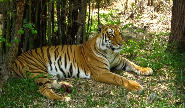
The reason this pocket has stayed semi-rural while comparable distances out on other Bangalore arterials filled in completely is at the end of the road. Bannerghatta National Park covers 260.51 sq km and is contiguous with the Talli reserve forest to its south-east and the Bilikal forest to its south; the Bannerghatta Biological Park, zoo, safari, butterfly park and rescue centre, occupies 731.88 hectares carved out of it in 2002. Because the road runs into protected forest rather than into the next suburb, there is a hard southern limit on how far the built city can spread down this corridor. That is a durable feature of the geography, not a marketing claim.
One caution belongs with it: a forest edge is a living one. Weekend traffic toward the Biological Park is heavier than midweek traffic, and the interface between farmland and forest in this part of Karnataka is a real one that the Forest Department manages actively. Read more on the Bannerghatta National Park page.
Everyday Life at Bilwaradahalli
Schools
The corridor carries a real set of schools, several of them with 560083 addresses on Bannerghatta Road itself, Sherwood High at Basavanapura near the NICE Road junction, Radcliffe International School at the 15th Milestone, Sarala Birla Academy on the Bannerghatta–Jigani road, and the Global Indian International School campus at Gollahalli. Ten other schools carry measured distances from the site, by car and by bike, beginning with Ryan International School at 3 km, EuroSchool Bannerghatta at 4 km, and ORCHIDS The International School and Chrysalis High School at 4.1 km. The distance table, and the addresses for the schools without a measured distance, are on the schools page.
Healthcare
Day-to-day medical care is available locally at Gottigere and Kalena Agrahara. Medax Hospitals, Gottigere is the nearest hospital with a measured distance, at 5.9 km and 20 minutes by car, followed by Noble Multispecialty Hospital at 6.8 km and 23 minutes and Sri Sairam Hospital, Hulimavu at 9.7 km and 32 minutes; Narayana Nethralaya at 7.3 km is an eye hospital rather than a general multispecialty. Vijayashree Hospital on Bannerghatta Road at Gottigere has no measured distance and is given by address. The large multi-speciality hospitals are further north on the same road, Fortis at 10.1 km and 37 minutes and Apollo at 10.9 km and 41 minutes, with the Sri Jayadeva Institute of Cardiovascular Sciences at the Outer Ring Road junction, again by address. Travel times are typical and vary with traffic and time of day. The full table of eight is on the hospitals page.
Getting Around
BMTC runs the length of Bannerghatta Road out to Bannerghatta, so the pocket is on a bus route, though services thin as you go south. Bilavaradahalli Cross is 190 m from the project's main gate, a two-minute walk, but it is thinly served, at about fourteen departures a day on the 371-A, 371-C and 371-D to KR Market and Kempegowda Bus Station, the 398-B to Chandapura and Kaggalipura, and the 211-NB. The frequent Majestic routes run from Bilavaradahalli, 1.5 km away, and Bannerughatta Circle, 2.3 km away, which is also where the KIA-14A leaves for the airport. Anyone relying on a bus daily should plan around those two rather than the stop at the gate, and the timetable says why: the first bus from Bilavaradahalli Cross is 5:51 AM and the last is 7:04 PM, so there is no evening or night service from it, and there is a gap of more than two hours between the 9:59 AM and the 12:14 PM. Timings as shown on Google Maps in July 2026. BMTC schedules change, check the live departure board at mybmtc.karnataka.gov.in before you travel. The full fourteen-departure table is on the connectivity page. The other two stops have no published timings yet. BMTC spells the stops Bilavaradahalli and Bannerughatta; this page writes the village Bilwaradahalli and the road Bannerghatta after the postal address, the same places under two spellings. There is no railway station on the corridor and no metro station in service on Bannerghatta Road itself: the Pink Line's southern terminus at Kalena Agrahara is 6.3 km north of here and not yet open. It was due to open on 15 August 2026; Deccan Herald reported in July 2026 that it would miss that deadline and is now expected in late August or early September, pending signalling validation and the statutory safety inspection. The nearest station a resident can use today is 12.5 km away, at Yelachenahalli or Silk Institute on the Green Line. The connectivity page sets out the road, metro, rail, bus and airport position in full.
Who Bilwaradahalli Suits
It suits a household that wants land and a low-rise home on a full arterial, is comfortable driving for hospitals and shopping, and values a green edge with a hard limit on it. It suits people whose work is in the Electronic City, Bommasandra or Jigani direction, because the NICE Road crossing at Gottigere opens that side without a city run. It does not suit someone who needs a metro station now, who wants a mall and a multi-speciality hospital within walking distance, or who is unwilling to make an unaccompanied drive at night on a highway with stretches of open country on it. Both descriptions are accurate; which one applies is a question about your household, not about the address.
Nambiar Beverly Park at Bilwaradahalli
The project is a 76-acre master development with a 36-acre first phase of 298 plots, on which G+2 villas are built, four bedrooms, a private lift serving all three levels, and a second floor given over to terrace: a multipurpose hall, celebration and wellness terraces, a yoga deck, a dance deck and a barbeque zone. Plots in the first phase are principally 35 × 55 and 40 × 63, at 1,925 sq.ft. and 2,520 sq.ft. respectively. The layout documented for the scheme includes six landscaped parks along the southern edge, 12 m and 12.19 m internal roads, 9.14 m secondary roads, an entrance plaza with a dedicated bus bay, and a retail block at the gate. Villas are offered at an indicative ₹13,499 per sq.ft. of saleable area, from about ₹5.48 Cr for a 35 × 55 and ₹6.82 Cr for a 40 × 63, inclusive of development and infrastructure charges and 5% GST, and excluding registration and stamp duty. East-facing and corner plots carry a preferential-location charge. These are indicative pre-launch figures and are subject to change. See the master plan, the villa layouts and the price page.
What to Verify Before You Buy Here
- K-RERA: registration has been applied for and approval is expected by 20 August 2026, the project is pre-launch. Once granted, the K-RERA registration is the legally binding source for approvals, areas and timelines. Check at rera.karnataka.gov.in.
- Title, khata and survey numbers: village land on this corridor is held in survey numbers, so ask for the conversion order and the approved layout plan.
- Launch and possession: no dates have been announced, and none are estimated here.
- Distances: the measured figures are the ten school distances and travel times on the schools page, the eight hospital distances and travel times on the hospitals page, six mall distances, six tech-park distances and travel times, three metro-station distances, 15 km to Electronic City at 30 min by car and 30 min by bike, 68 km to the airport at 2 h by car and 1 h 58 min by bike, and 3 km to the Bannerghatta Nature Camp. Travel times are typical and vary with traffic and time of day. Measure anything else that matters to you in Google Maps from the project coordinates, 12.823744, 77.571837.
*Travel times are typical and vary with traffic and time of day. Related reading: location overview, the corridor, connectivity and Bannerghatta National Park.
Frequently Asked Questions
1. Where is Bilwaradahalli?
On the southern reach of Bannerghatta Road in south Bangalore, between Gottigere and Bannerghatta. The pincode is 560083 and the postal head office is Gottigere. Nambiar Beverly Park is here, at 12.823744° N, 77.571837° E, 3 km from the Bannerghatta Nature Camp.
2. What is the locality actually like to live in?
Semi-rural. Village settlements, farmland and granite outcrops along a state highway, with gated schemes arriving from Gottigere. Air, noise and sightlines beat the built stretch of the corridor; retail is local, and everything larger is north of you. A car is not optional.
3. What is nearby for schools, hospitals and shopping?
Sherwood High, Radcliffe International School, Sarala Birla Academy and the Global Indian International School campus are the schools on this corridor. Local healthcare starts at Gottigere and Hulimavu, with Fortis and Apollo further out; everyday retail is at Gottigere and Kalena Agrahara.
4. Why has this pocket stayed semi-rural?
Because of what is at the end of the road. Bannerghatta Road terminates in protected forest, not the next suburb: the national park covers 260.51 sq km, so there is a hard southern limit on how far the built city can spread.
5. What should I check before buying at Bilwaradahalli?
Three things. The K-RERA position, no registration number has been allotted, so it is pre-launch; verify at rera.karnataka.gov.in. Title, khata, conversion order and approved layout plan. And any distance that matters, measured yourself.
Explore Nambiar Beverly Park